Miami River History: How Miami's Original Waterfront Still Shapes Real Estate Today

Published May 23, 2026 by William Gartin Real Estate.
Before Miami became a skyline of glass towers, luxury condos, restaurants, bridges, and waterfront walkways, it was a river city. The Miami River was the meeting place where freshwater from the Everglades moved toward Biscayne Bay, where Tequesta people lived and traded, where early settlers built homes and businesses, and where the young city began to imagine itself as more than a small settlement at the edge of South Florida.
For buyers, sellers, homeowners, and investors, that history is not just interesting background. It still shapes how people experience Downtown Miami, Brickell, the Health District, Spring Garden, the riverfront condo market, and the broader conversation about waterfront living in Miami. Understanding the Miami River is one of the best ways to understand how Miami history, Miami architecture, preservation, mobility, and real estate growth are connected.
Why This Part of Miami History Still Matters
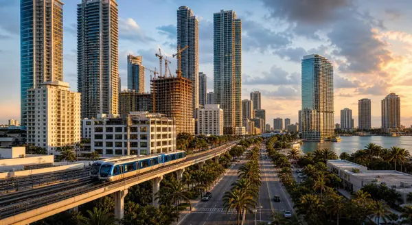
The Miami River is short, but its influence is enormous. The Miami River Commission describes the river as a 5.5-mile working waterway that flows through the heart of Downtown Miami into Biscayne Bay. Long before modern cranes, marinas, and condo towers, the river was a practical lifeline. It offered food, transportation, trade, shelter, and access between the Everglades and the bay.
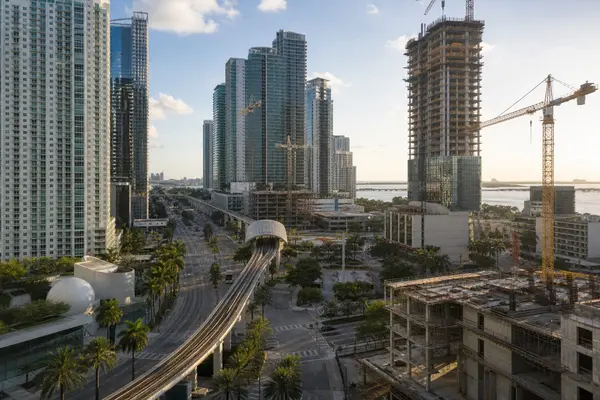
That same geography explains much of Miami's modern appeal. Waterfront access remains one of the strongest lifestyle and value drivers in Miami real estate. Views, boating access, walkability, restaurant activity, public promenades, and proximity to Downtown all help shape demand. The Miami River's story also reminds us that land near the water has always carried extra meaning in South Florida. It is valuable because it is beautiful, useful, limited, and deeply tied to the city's identity.
The Historical Background
According to the Miami River Commission, the river evolved over thousands of years from a tidal channel into a freshwater stream carrying water from the Everglades to Biscayne Bay. Archaeological evidence at the Miami Circle at Brickell Point shows the deeper Native history of the area. The Florida Division of Historical Resources notes that the Miami Circle was discovered during archaeological salvage excavations in 1998 and consists of holes and basins carved into shallow limestone. The site is now a National Historic Landmark.
The National Park Service identifies the Miami Circle at Brickell Point as part of the primary village of the Tequesta people, one of the first Native North American groups encountered by Juan Ponce de Leon in 1513. That matters because many people think of Miami as a young city founded in 1896, but the mouth of the river was important for centuries before incorporation.
In the 1800s, settlement along the river became more visible. William English built a plantation at the mouth of the river on the north bank in 1844, and during the Seminole Wars the U.S. Army used the property as Fort Dallas. Later, Julia Tuttle owned land on the north side of the river, while the Brickell family owned land on the south bank. The University of Florida's Ingraham Expedition materials describe Miami in 1892 as a sparsely populated, unincorporated community clustered near the mouth of the Miami River.
Key People, Places, and Events
Several names appear again and again in the history of Miami Florida because their decisions shaped the city around the river. Julia Tuttle persuaded Henry Flagler to extend his Florida East Coast Railway to Miami, and the city incorporated in 1896. Flagler's Royal Palm Hotel opened at the river's mouth the following year, bringing visitors, investment, and visibility to a place that was still surrounded by wetlands, hammock, and Biscayne Bay.
The natural river also changed dramatically. The Miami River Commission's historical overview explains that early tourists took paddlewheel trips upriver toward the rapids, which were formed by a natural ridge that carried Everglades water toward the bay. From 1909 to 1933, the river was lengthened and widened, the rapids stopped after Miami Canal work began, and by the 1930s the river had become a 5.5-mile navigable channel. That engineering helped commerce, but it also changed water flow, ecology, and the character of the surrounding land.
As Miami grew, the river became a working corridor for warehouses, docks, boatyards, marine repair, shipping, and eventually World War II industrial activity. The same waterway that had once drawn settlers and tourists became a place of trade, labor, and infrastructure.
Historic Places You Can Still Visit Today
One reason the Miami River is such a useful topic for people thinking about living in Miami is that the history is still visible. The Miami Circle at Brickell Point sits near the river's mouth in the middle of one of Miami's most valuable urban real estate markets. Brickell Avenue Bridge, Fort Dallas Park, Lummus Park, the Riverwalk, and older river neighborhoods such as Spring Garden all help show how Miami layers old and new together.
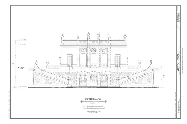
The City of Miami's Historic Preservation Division emphasizes that Miami has more than 100 individual historic resources and sites plus local historic districts. It also notes that Miami's significant properties include residential neighborhoods, Mediterranean Revival villas, Art Deco homes, Craftsman bungalows, Bahamian cottages, major landmarks such as the Freedom Tower and Olympia Theater, and archaeological zones. That preservation framework affects how some Miami historic homes and older neighborhoods are renovated, valued, and marketed today.
How This History Shaped Miami's Neighborhoods
The river helped define the geography of early Miami. The north bank connected to Fort Dallas, Downtown, and later civic and commercial growth. The south bank helped shape Brickell, first as an estate and residential area, then as a financial district, and now as one of the strongest urban luxury markets in Miami. Upriver, the working river supported industrial uses, boatyards, marine businesses, and older neighborhoods that developed with a very different feel from the bayfront towers.
This is why two properties only a few blocks apart can feel completely different. A riverfront condo in Brickell may be shaped by views, walkability, restaurants, and access to Downtown offices. A home near Spring Garden or the Health District may reflect older street patterns, mature trees, proximity to major employment centers, and a quieter residential feel. Historic Miami neighborhoods are not interchangeable. Their value often comes from the specific story of how each place developed.
What This Means for Miami Real Estate Today
Today, the Miami River is still evolving. The Miami River Commission was created by the Florida Legislature in 1998 as the official coordinating clearinghouse for public policy and projects related to the river. The commission's planning work, including the Miami River Corridor Urban Infill Plan, helped guide redevelopment, cleanup, greenway segments, parks, and thousands of planned residential units near Downtown.
The Miami Downtown Development Authority reports that the public waterfront promenade idea has been decades in the making. Its Baywalk and Riverwalk work highlights the importance of access, lighting, shade, wayfinding, resilience, and consistent design. As of the DDA's posted status, the 10-mile Miami Riverwalk and on-road Greenway are still being completed in sections, with new riverfront projects contributing pieces of the larger public experience.
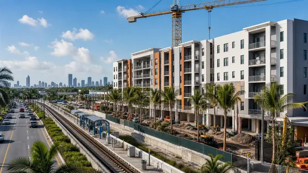
For real estate, this creates a few important takeaways. First, waterfront property is not only about a view; it is also about public access, seawall standards, resiliency, flood exposure, insurance, walkability, and long-term city planning. Second, older and historic properties may involve preservation review, archaeology, zoning, or design constraints that buyers should understand before making plans. Third, new riverfront development can increase lifestyle appeal but may also bring construction, traffic, assessments, or changes to neighborhood character.
If you are comparing waterfront homes in Miami and South Florida, looking at Miami luxury real estate, or watching new construction opportunities, the Miami River is a reminder to study the land, the infrastructure, and the history behind the listing.
Why Buyers and Sellers Should Understand Miami's History
Buyers benefit from understanding history because it helps explain why certain streets, buildings, and neighborhoods command attention. It can clarify why one waterfront site feels polished and pedestrian-friendly while another still feels industrial or transitional. It can also help buyers ask smarter questions about elevation, flood zones, parking, bridge openings, boat traffic, views, future construction, and public access.
Sellers benefit because history can add context to a home's story. A property near a historic corridor, an older neighborhood, a waterfront walkway, or a landmark district may have appeal that goes beyond square footage. Good marketing should connect the physical property to the lifestyle and neighborhood story around it. That is especially true in Miami, where architecture, culture, water, immigration, tourism, and redevelopment all influence buyer demand.
Investors should pay attention because riverfront and historic-adjacent areas often involve both opportunity and complexity. The best decisions come from understanding not only rents and comparable sales, but also zoning, public plans, preservation issues, resiliency investments, and the long-term direction of Miami-Dade real estate.
Final Thoughts from William Gartin Real Estate
The Miami River tells the story of Miami in one place: Indigenous history, early settlement, Fort Dallas, Julia Tuttle, Henry Flagler, the railroad, dredging, commerce, pollution, cleanup, public access, historic preservation, and modern waterfront development. It shows how Miami became a global city without losing the traces of the river landscape that made the city possible.
If you are thinking about buying or selling a home in Miami, it helps to work with a Realtor who understands not just the market, but the history, neighborhoods, architecture, and long-term growth of the city. William Gartin and his team help buyers and sellers make informed decisions throughout Miami and South Florida.
William Gartin Real Estate
305-842-6097
williamgartinrealestate.com
Facebook: https://www.facebook.com/williamgartinre
Buyer questionnaire: https://hul1lsz36ih.typeform.com/to/xmGciMYj
Sources and Image Credit
- Miami River Commission: Miami River History
- Miami River Commission: About the River
- Miami River Commission: About the Commission
- University of Florida Smathers Libraries: Ingraham Expedition, Miami River
- Florida Division of Historical Resources: Miami Circle
- National Park Service: National Historic Landmark nomination guidance, Miami Circle example
- City of Miami Historic Preservation Division
- Miami DDA: Baywalk and Riverwalk Waterfront Design Guidelines
- Miami DDA: Baywalk and Riverwalk Completion
Featured Image Notes
- Image URL: On the Miami River, Florida, 1900
- Image credit/source: Detroit Publishing Co.; Library of Congress Prints and Photographs Division; public domain via Wikimedia Commons.
- Suggested alt text: Historic 1900 photochrom view of the Miami River with palm-lined banks before Downtown Miami and Brickell became high-rise waterfront neighborhoods.
- Caption: On the Miami River, Florida, 1900.
- Why it fits: The image shows the river before Miami's modern skyline, helping readers see how a natural and early commercial waterway became one of the city's most important real estate corridors.
Categories
Recent Posts